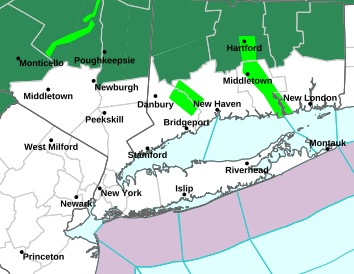
 Hurricane Irene appears to be weakening slowly as it approaches the NC Coastline. She remains a Cat 2 hurricane with 100mph sustained winds and gusts upwards of 115mph. Hurricane WARNINGS are posted from Little River Inlet, SC to Sagamore Beach, MA, encompassing 29 million people!
Hurricane Irene has stabilized and the minimum pressure has actually dropped slightly, which could be a sign of some minor strengthening. Once she crosses the NC coast, Irene will continue to weaken to a Category 1 storm by the time it reaches NYC. That's good news, right? NOT QUITE! Yes, it is good that the max winds have decreased; however, this storm is so massive and the wind field so expansive that the effects will be widespread, prolonged, and destructive. Storm surge along the Jersey Shore and Raritan Bay will be in the 5'-10' range.
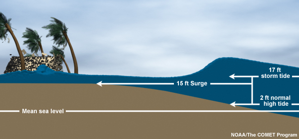 For those of you who do not know what storm surge is, let me take a minute to explain. Some people believe it is simply flooding. Storm surge is much more dangerous than simply flooding. Storm Surge is defined as the abnormal rise of water from a storm, over and above the predicted astronomical tide level. Storm TIDE is defined as the combination of storm surge and astronomical tides. See the picture to the right for further explanation. Storm tides could reach 12'-15' along the coast during high tide Sat/Sun, as the astronomical high tide will be abnormally high due to the new moon phase. Unfortunately, the peak storm surge for Irene is expected to occur during the morning high tide along the coastline. Historically, more people have died and property damage destroyed from storm surge than the wind.
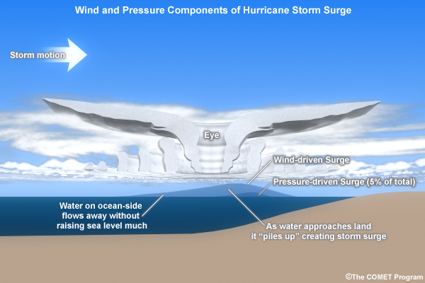
Worst case scenarios in NYC call for up to $50-$100 billion in damages. Storm surge associated with this storm could flood the Holland and Brooklyn Battery Tunnels, lower Manhattan, and could leave JFK Airport under 10'-20' of water!
Extended power outages are expected as the saturated ground will enable more trees and power lines to become weak at their roots and easily fall. People are advised to prepare for no power over the next few days by stocking up on water and canned foods. If you have not done so already, please be sure to do that tomorrow morning.
State OEM has initiated evacuation orders for the Jersey coast from Keansburg to Cape May. The Garden State Parkway will be shut to all southbound lanes at 8pm tonight and Mass transit will be suspended at NOON tomorrow. Voluntary evacuations are issued in flood prone areas including Hoboken, NJ and Belleville, NJ. As per the Belleville OEM:
"An Urgent Message from the Township of Belleville
The Police Department is hereby requesting a Voluntary Evacuation of residents living in known flood areas.
If you are receiving this message, and live near or around, 725 Joralemon Street, the South end of Fairway Avenue, 1-3 Franklin Avenue or on Main Street, your area has been designated a potential flood zone and you are requested to voluntarily evacuate. If possible please make arrangements to stay with family or friends. Belleville High School has been designated a Pet Friendly shelter and will be available from 5am Sunday Morning."
Keep in mind, during the peak of the storm, no police or emergency response units will be out. They will not tend to emergencies until the storm passes. So if you are in an evacuation area and are not comfortable with that fact, please heed the evacuation orders and leave immediately.
I will be out and about taking videos and reporting on the storm as it hits tomorrow evening and sunday afternoon. The videos will be posted as long as I have power. To those waiting out the storm, I wish you all the best, and know that you are living through history this weekend. In 20 years, when people say, "Do you remember Hurricane Irene in 2011?" you can say, "yes, I lived through it!"
Be sure to click on the Hurricane Irene tab on the top of the page to see satellite, radar, and forecast images as the storm approaches.
No comments:
Post a Comment